Walking the St Cuthbert’s Way
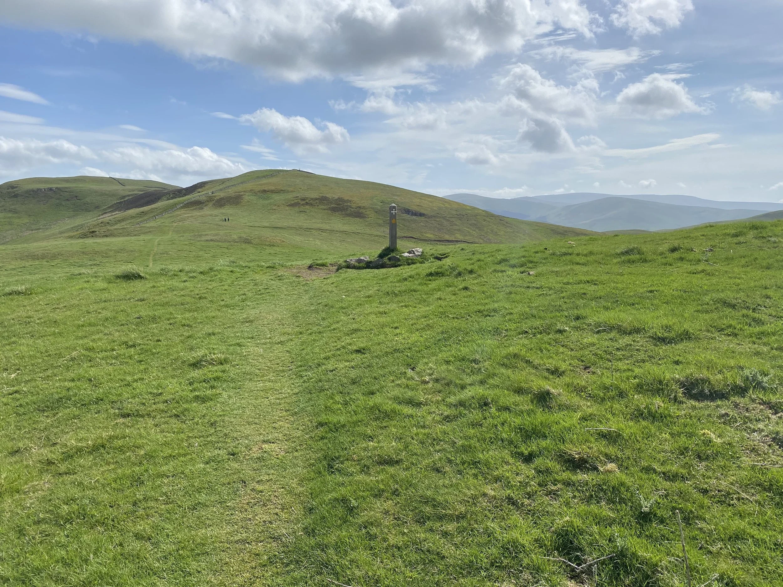
Marker at the top of Wideopen Hill
Walking the St Cuthbert’s Way
Bordering Scotland and England, the historical St Cuthbert’s Way is a 62-mile trail from the town of Melrose to Lindisfarne and Holy Island. Having read countless articles about the weather, historical sites, and how nice and easy the trail is, I expected a joyride. But it is far more CHALLENGING and BEAUTIFUL than people let on. While not as difficult as many national trails in the United Kingdom, St Cuthbert’s Way is far from easy.
Based on my experiences, here are the things (big and little) I wish I knew before my journey, and a breakdown of each day based on:
what was underfoot
elevation and how long the climb took
distances
places to eat and spots to rest
If you are reading this article you must be interested in walking St Cuthbert’s Way or preparing for the journey. If you are prepared you CAN do this trail.
Beauty
Wow! Just wow. I was not expecting forests of flowers or fields of rapeseed – little yellow flowers on long green stalks as far as the eye could see. We walked St. Cuthbert’s Way in the middle of May with wildflowers in full bloom. We would walk around a corner onto a forest track, white and pink flowers lined the trail and covered the ground between the trees. Spectacular! The views from Wideopen Hill and Tom Tallon’s Crag were breathtakingly calm and peaceful. It’s why you huff and puff with your chest burning and sweat dripping down your beet-red face, for the unmatched beauty and feeling of inner peace. It’s the time to take a seat, drink some water, have a snack, and reflect on your life.
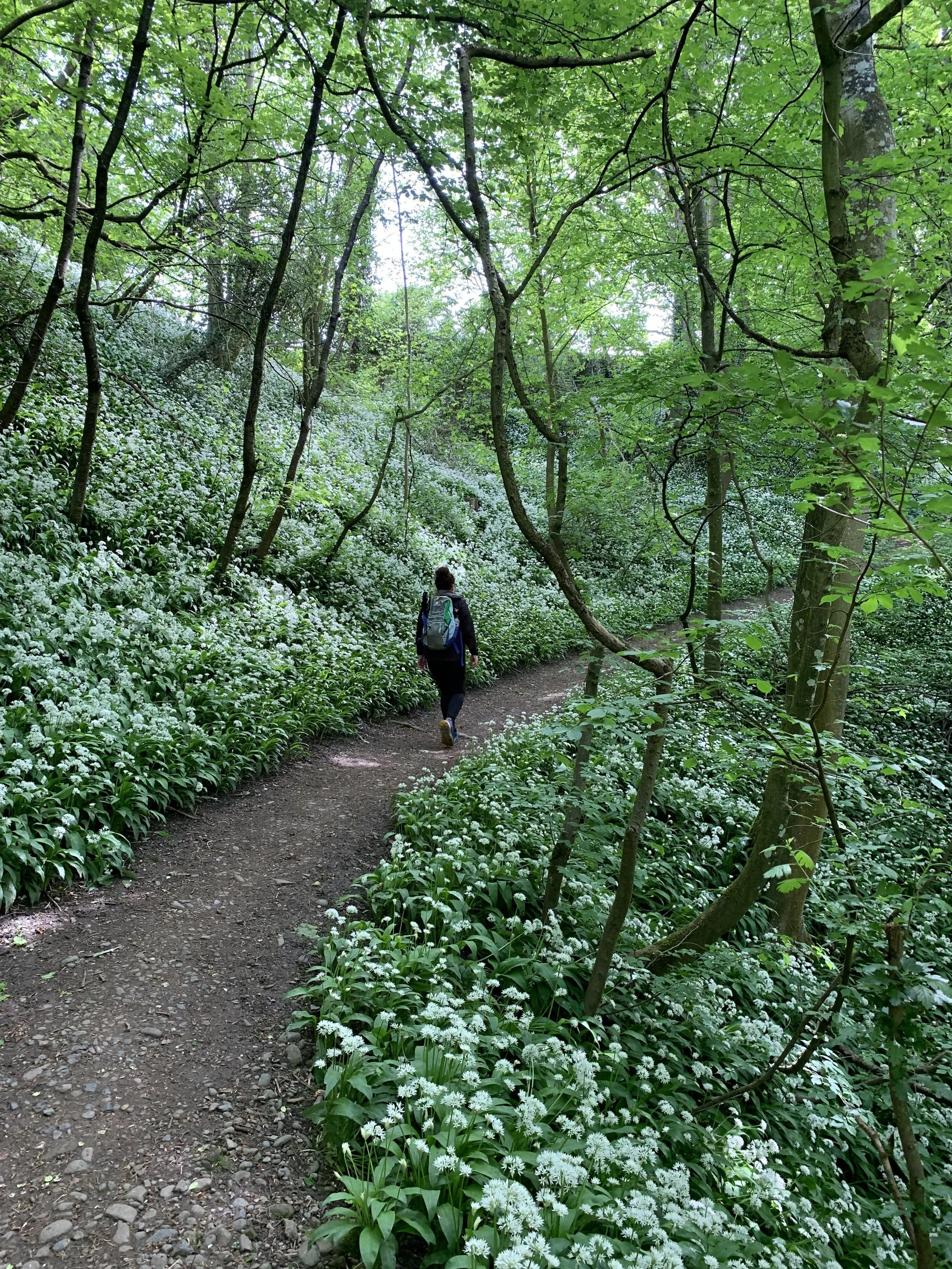
Walking through one of the many beautiful woodland sections covered in flowers
How long does it take to walk St. Cuthbert’s Way?
You can walk this trail in anywhere from 4 to 7 days. We chose to do it in 7 days because we wanted to take our time, look at the scenery, and spend more time at the pub with good friends at the end of each day. Taking your first sip of beer after walking 12 miles is beyond satisfying.
The Terrain
For me, terrain preparation and knowledge is always the most important part of deciding which long distance hike I am going to tackle. St. Cuthbert’s Way has a lot of positives when it comes to what’s underfoot, but also some drawbacks. I will detail the daily terrain in my segment section, but overall there were awesome short-packed grass paths over the steeper elevation climbs, some road walking, very narrow dirt paths where you needed to put one foot directly in front of the other (not my favorite), sheep pastures, and of course 3 miles of packed sand when you make the final crossing to Holy Island.
Difficulty
This walk is professionally rated as easy to moderate, and yes it can be challenging. While it’s not the Coast to Coast trail or Mount Everest, getting up every day for 6 days in a row and walking 8 to 16 miles with steep climbs is a challenge for almost anyone. A professional pickleball player might be fit, but that’s not the same as endurance. I would recommend building up to walking 8-10 miles a day for a couple of days in a row before starting any long-distance walk. Keep in mind that this walk has a total elevation climb of 6808 ft.
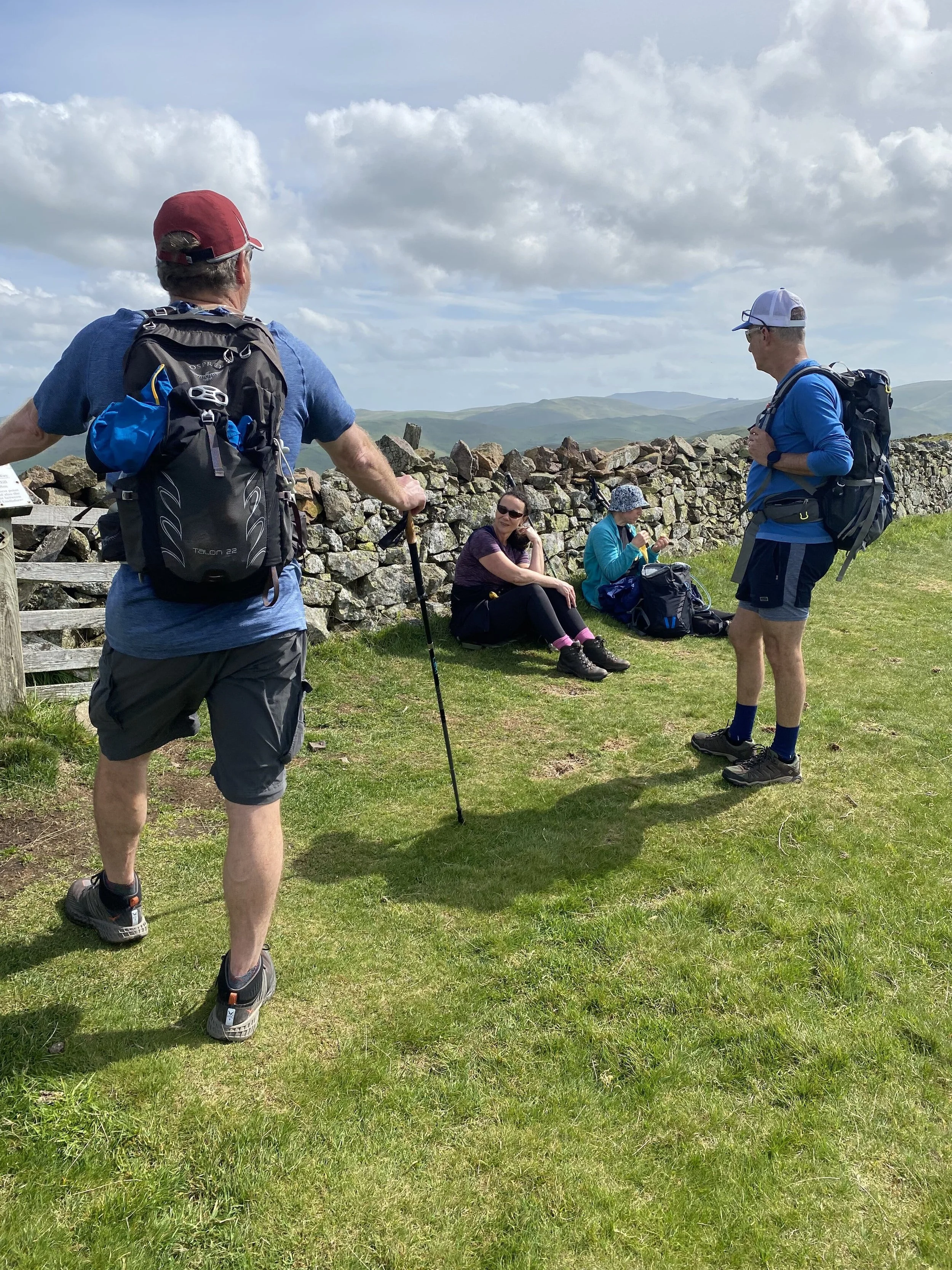
My Group

My group on the last day
My group walked from inn to inn while our luggage was transferred, something I highly recommend. We are all middle-aged American, a mix of seasoned walkers and those new to long distance hiking. I was conscious of this when I planned the trip because it be awful for new walkers to feel overwhelmed. Luckily, we all survived and only one person got a blister. Our group was made up of two couples and for us was an ideal size. We all had different experiences but all loved this trip and would highly recommend this walk for groups, couples, or solo walkers. St. Cuthbert’s Way can definitely lead hiking newcomers to get hooked on long-distance walks.
Shoes
By far the most important part of any long-distance walk is your choice of footwear! So many people said you must have waterproof hiking boots but that is NOT the case. I have completed four long-distance walks in HOKA Stinson all-terrain (and highly breathable) shoes. A sturdy and trusted pair of sneakers is all you need. Whatever your comfort preferences you MUST love your shoes. You will be wearing them through some pretty hard stuff and you don’t want to get blisters, lose a toenail, or detract from enjoying your journey. You are out there to test yourself and have the time of your life.
To be honest there were two days where I could have used waterproof socks or real hiking boots. Day 3 was raining which is not a problem for all-terrain shoes, but the raindrops stuck to the long grasses, and as I walked through them the water soaked through the top of my Hokas. But they dried quickly and I only had to walk in squishy shoes for an hour or so. I even managed to avoid getting a dreaded blister.
Arriving in Melrose

Melrose High Street
By train:
Tweedbank is the nearest train station and is a 1 hr 15 min train ride from Edinburgh, then a 10-min bus ride into Melrose.
If you’re coming from Glasgow you will need to transfer trains in Edinburgh.
By car:
Glasgow to Melrose is 1 hr 33 min (82 mi).
Edinburgh to Melrose is 58 min (39.2 mi)
We took an Uber from Edinburgh to Melrose which was convenient and cost £75. (May 2022).
Melrose
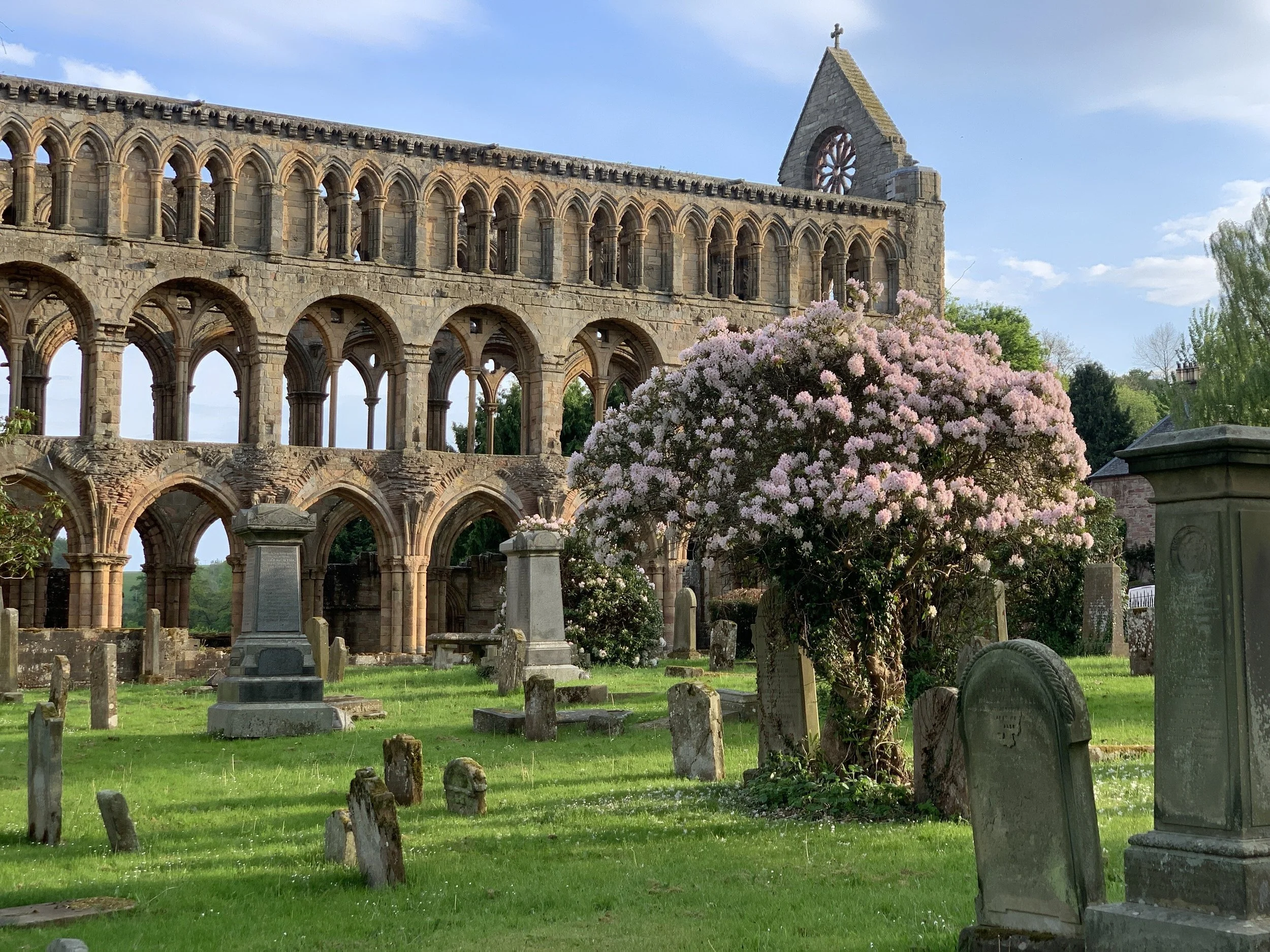
At the start of St. Cuthbert’s Way, Melrose is a cute border town in Scotland with a handful of hotels, inns and B&Bs. We stayed in the Kings Arms Hotel, one of my favorite places we stayed. It had good food and drinks, nice rooms and friendly people.
The Melrose Abbey was closed for restoration when we were there and we couldn’t go inside. Perhaps the most fascinating thing is that Robert the Bruce’s heart is embalmed and buried beneath the Abbey. The Abbey has a rich history, being built in 660 A.D., burnt down by Edward II, and rebuilt by Robert the Bruce in 1322. But for some reason, I was fascinated that his heart, and only his heart, is buried there. Where is the rest of his body? Is it scattered all over Scotland? I thought maybe I would find out along the way but had to look into it later.

Melrose Abbey
Day 1: Melrose to St. Boswells
8 miles
Ascent:1058 ft./323 m
Based on everything I had read, I was worried about this first climb. Andrew from EasyWays (the booking company) warned me this is the steepest and most strenuous climb of the walk. I was nervous with anticipation, and he was right it was a heart burner. But I don’t think it was the most challenging climb of the trip. I will break it down for you so you don’t need to think about it again.

Part of the initial staircase
Right after leaving Melrose, the path takes you to a long staircase (with handrail) with steps of wooded slats covered with chicken wire. The staircase is long but there is a bench at the top to rest if needed. As soon as you’re done with the staircase, you go straight to a dirt and gravel path with a wooden step every 3-4 paces. There is another bench at the top of this section for a little rest. The path then becomes a packed clay surface. It is still steep, but more of a switchback leading to the top of Eildon Hill.
The total climb was 793 ft./241 m, 1.38 miles, and took us 40 mins.

The section of packed clay surface
From the top, the view over the valley was amazing. The remaining 7.6 miles were nicely downhill through forest tracks with a dirt path. There were a few more ups, but nothing challenging, just birds singing and the wind blowing in the trees all the way to St. Boswells.
After the day’s hike, I was thrilled to have made it up the “most challenging” climb without wanting to give up. I knew then I could make it up anything this trail would throw at me.
St. Boswells is a lovely town with beautiful homes, churches, and gardens. We stayed at the Buccleuch Arms Hotel, well located in the center of town and with a great beer garden. We sat out and enjoyed the afternoon sun, drinking beer and chatting until the sun went down. The only downside of our experience in St Boswells was it was a Saturday and the two main restaurants in town were booked out (a wedding at the Italian restaurant and a 21st birthday at the hotel). We ended up having Chinese takeout while sitting on a picnic bench in the beer garden.
Enjoying aa beer at the end of the day
Day 2: St. Boswells to Jedburgh
14.7 miles
Ascent: 1150 ft./350 m
This section is lovely. We walked through forests of flowers, past churches, a sprawling green golf course, and a bubbling river with swans and fly fisherman. It was probably the most pleasant day of walking on the journey.

The path along the River Tweed
As you leave St. Boswells you follow the road out of town until you reach the golf course. The path is mainly short grass and is well shaded as soon you reach the River Tweed. The grass path follows the length of that section of the river and makes up about a quarter of the day's trek.
When you leave the river, you enter a forest with a wide dirt path that gently winds up the hill. This portion was breathtaking in mid-May, the flowers were sprawled along the path, up the hills, and around every corner. This section was well shaded because of the trees. The terrain was consistent, with only a few wooden steps in steeper parts. When you reach the top, you step out the forest onto a country road and pass a functioning old stone church with headstones nicely placed in its grounds, and then walk alongside grain fields.
Walking through the forest track
The gradual descent was the same wide spongy dirt path as the ascent we crossed over streams, flowers blanketed the ground, and the path wound pleasantly to Harestanes.
Coming out of the forest track, you pass the Harestanes Visitor Center. From here you can call a taxi to take you the 4 miles into Jedburgh, or walk down the quiet country road into town. These 4 miles are NOT part of St. Cuthbert’s Way, so it adds mileage to your day! We chose to walk the 4 miles and then take a taxi back to the trail in the morning.
There were lots of benches, anywhere you would want one there was one. We always say, “don’t ever walk past a bench, you never know where the next one will be”. But on this occasion, we did not take our own advice. We passed them all and did not see another bench until we reached Holy Island.
Augustinia Abbey Jedburgh
Jedburgh is a large market town with a stunning abbey, the grandest of all the abbeys along St Cuthbert’s Way. The Abbey was closed on Sundays, as were most of the restaurants and pubs. Luckily the host at the Meadhon Guest House called the only sit-down restaurant open, The Carters Nest, and got us a reservation. I cannot tell you how nice it was to sit down and rest my feet after 14.7 miles.
Day 3: Jedburgh bridge to Morebattle
9.7 miles
Ascent: 1,125 ft./343 m
After leaving Jedburgh via the Canongate Bridge, you have a nice steady climb on a dirt road for a mile. The path then turns into long grasses, matted down as it climbs along the border of pastures. In a few areas, the path cuts across cow and sheep pastures, which can be a bit tricky when a cow is in the middle of the path. We just stopped and waited.

St Cuthbert’s Way through a cow pasture
Between Jedburgh and Morebattle, most of the 1,125 ft. in elevation is in the first 4 miles with some short steep climbs. This is followed by 5 miles on country roads weaving between fields of rapeseed, the bright-yellow flowers are a pleasure to walk alongside. You also walk past the ruins of Cessford Castle. This is a nice spot to take a break, sadly there are no benches but you can sit on a rock or pull out your pack liner and sit on the ground.
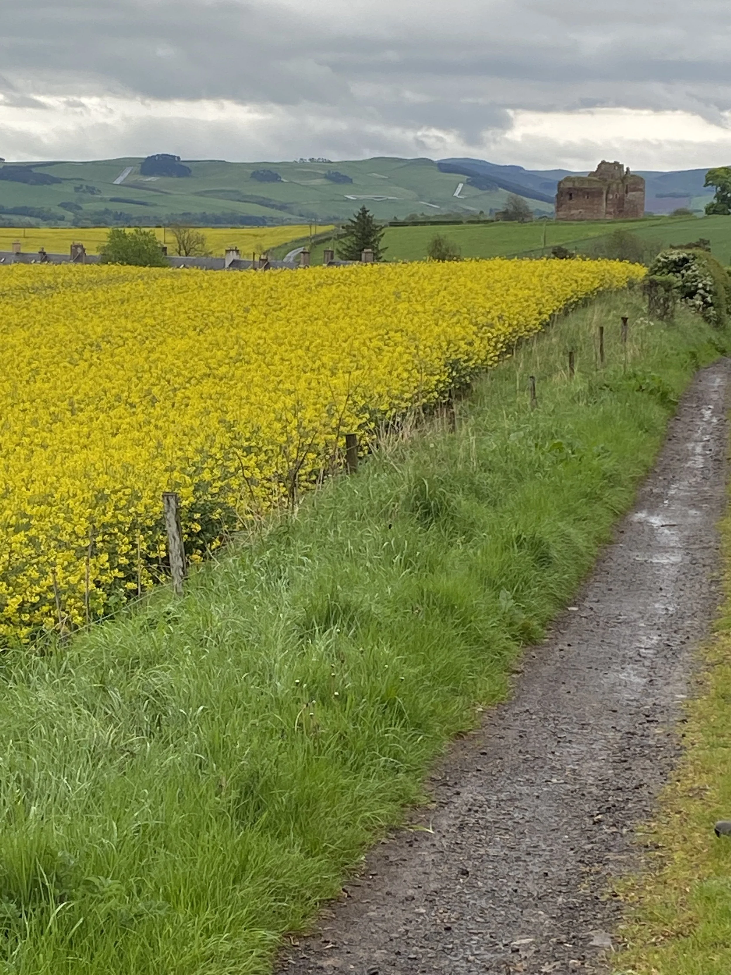
The path along fields of rapseed with Cessford castle in the back ground
Soon you will be arriving in Morebattle, a small and charming village with one pub and a small market which is perfect for restocking on water, snacks, and maybe some whisky (you might need a small nip after the upcoming climb).
We stayed at Templehall Hotel which is the only lodging in Morebattle, so if you want to stay there I would book early. This was a great hotel with kind and thoughtful owners. Our rooms were not ready when we arrived, so we sat in the pub and the owner asked us to pre-order our evening meals. We have been asked to pre-order our breakfast many times, but never dinner. She explained they have a lot of bookings and only a few portions of a few items. I loved this approach. She gave us menus and said she would be back later to take our order. I could pour over the menu, drooling of course, and settled on the fried wedge of brie as a starter and the salmon for the main. It was hands down the best meal of the trip. This may be starting to sound like a restaurant review, but if you are walking the whole section from Jedburgh to Kirk Yetholm, take the time to stop at the TempleHall Hotel.

Steps over a pastures wall
Day 4: Morebattle to Kirk Yetholm
7 miles
Ascent: 1,208 ft./359 m
The climb and view from Wideopen Hill are specular, worth every step, and I would love to do it again someday.
After you leave Morebattle you follow a nice country road for 0.6 miles, strolling past quaint cottages and picture-perfect estates.
Path up Wideopen Hill
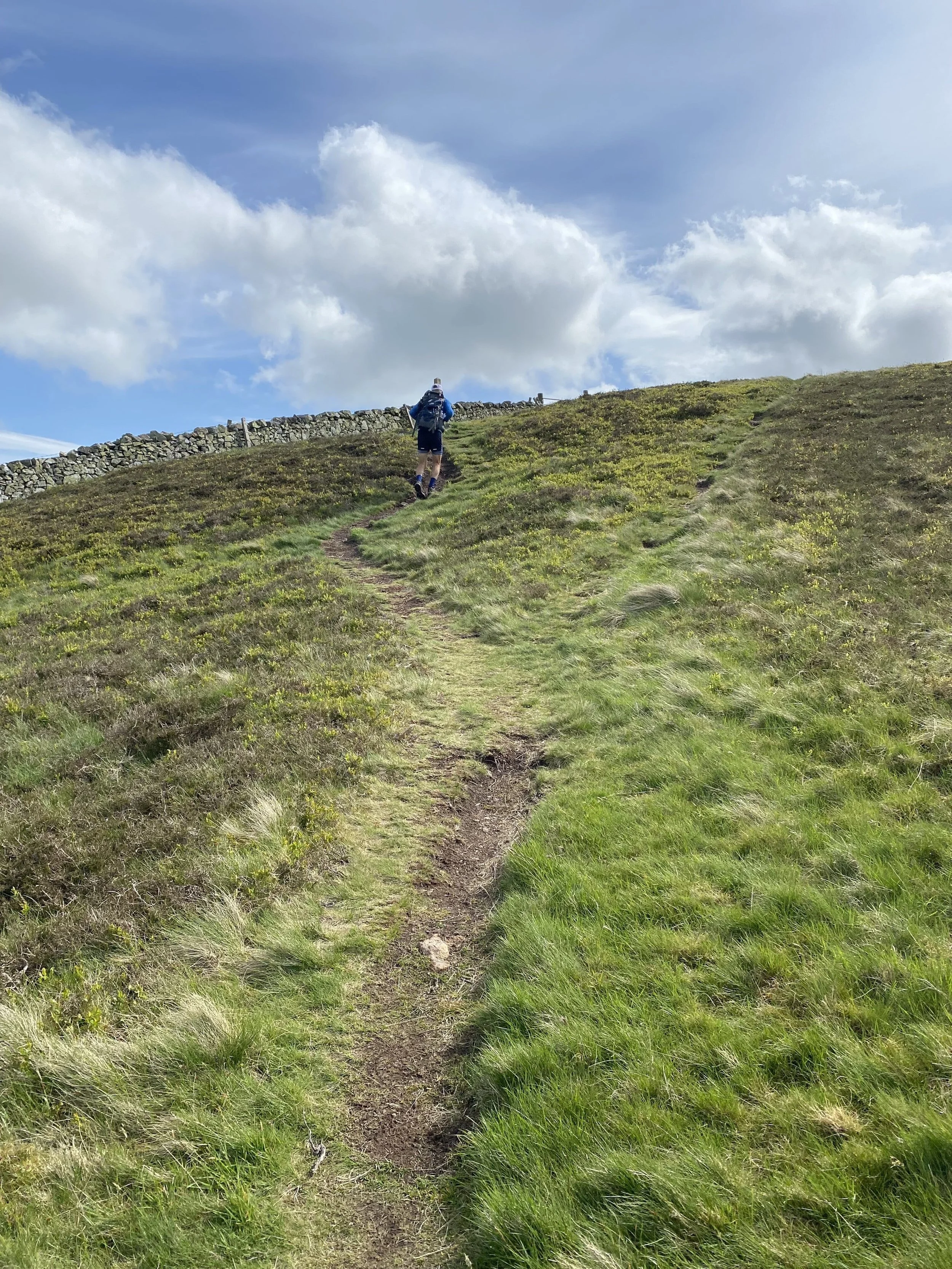
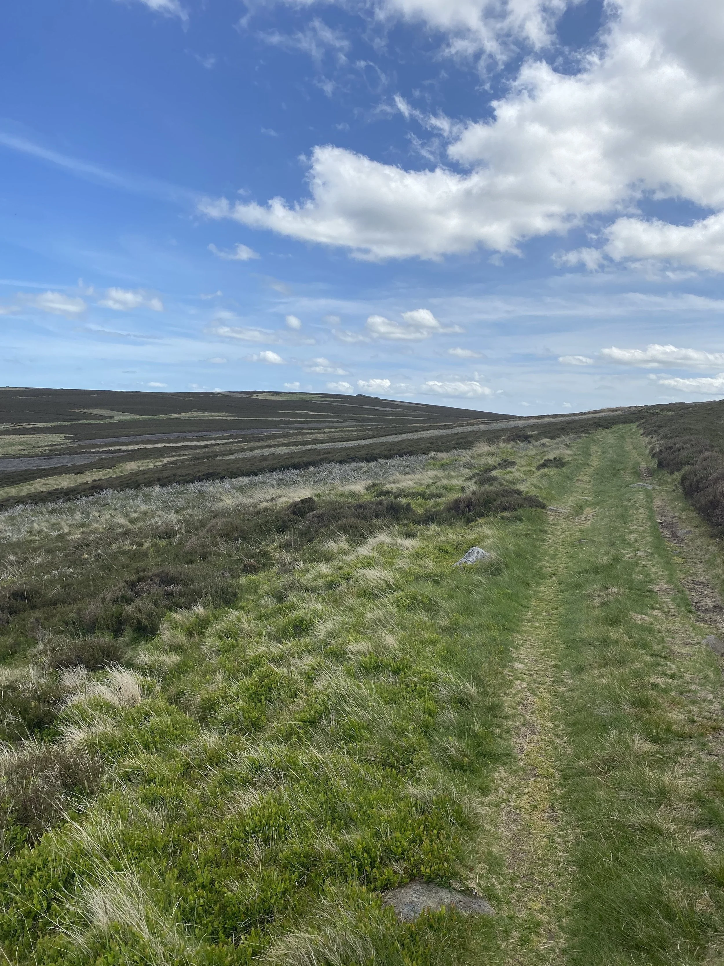
Then you start the steep climb up Wideopen Hill. Yes, this is a chest burner, but just put one foot in front of the other and take lots of breaks. I have never liked the steep climbs, but this one I enjoyed. Maybe it was the company or maybe knowing we had a short walking day.
At the start, the dirt path is about 2 foot-wide and runs along a fence bordering pasture. When you reach the end of the pasture you go through a gate and it opens to “Wideopen” green grass paths. The path looks like someone pushed a lawnmower to the top, but it really was matted down short grass (which was very nice on the feet and joints). When you reach the top, the views over the valley were spectacular. We stopped, sat down, looked back at our accomplishments, and ate a Snickers bar (my favorite trail food).

Grass path over the rolling hills
The climb to the top was 1,108 feet over 1.14 miles with zero switchbacks, 23% grade in many places, and with no benches. Yep, it was tough for me being 25 pounds’ overweight, but I managed well and enjoyed it.
The path going down was the same as going up. Straight downhill with zero switchbacks making poles a must for this section. I would not want to do this part of the walk in the rain, I would be afraid of slipping and riding the hill down like a rollercoaster.
The last 3 miles of the walk, take you through sheep pastures of grass and muck, until you reach Kirk Yetholm.
This is another small village, with one pub and a convenience store. We stayed at the Border Hotel, a nice old hotel and pub. I really liked the hotel itself, but we were booked into standard doubles that only had a skylight, no real window, so in the rain the skylight could not be opened. The room was so tiny that my husband had to put his suitcase under the bed and mine in the bathroom. This is the only problem with going through a booking company, you can’t pick your room. I have used the same booking company for walking the Great Glen Way and the rooms they selected were GREAT.
Taking a break at the top of Wideopen Hill
Day 5: Kirk Yetholm to Wooler
13.7 miles
Ascent 2230 ft./679.7 m
This is the most photographed section of St. Cuthbert’s Way. I’m sure you will recognize the scenery from blogs and booking company websites. But it is well-photographed for a reason. This was by far our groups favorite day.
After a full English breakfast, we set out excited and full of anticipation for what we would see when we crossed the border. We were not disappointed!
After leaving the village you walk on a country road that leads to the first steep climb. Once again it was lovely, soft, short grass for the first hill, followed by a descent to the Halterburn glen. The next climb comes right after the descent with the same underfoot. Poles were definitely needed for this section.

Steady climb with short grass under foot
The top of the hill was beautiful, with sprawling views of Tom Tallon’s Crag and rolling green hills. The trail you just came from becomes a picture-perfect postcard. The gradual descent passes through pastures of cows and sheep, then onto a farm road that leads you to the picturesque village of Hethpool. The village has two B&Bs but does not have a restaurant or any shops that we could find.
The journey up to Tom Tallon’s Crag is one you will remember. The path through tended farmland is wide and mostly grassy until you reach the top where it opens wide into a patchwork of purple heather. Walking through the heather-clad moors is like wandering through a happy version of Wuthering Heights.
Moorland walking section
The path itself (if you can keep your eyes on the ground) is soft and spongy with a combination of dirt and matted heather. As you wind through this lovely section you come across hunting blinds buried in the ground. My mind wandered thinking about the hunt for grouse (the bird that roams the moors), the hunters quiet in their blinds on a cold misty morning, gun dogs gracefully pointing and retrieving their trophy and their owner’s evening meal.
This moorland walk continued for 3 to 4 miles before dropping down to a tarmac road leading to a parking lot. From there, the path would have taken us through a forest track but unfortunately, a wind storm in the month prior had blown down many trees and blocked the path. There were signs warning us of a section closure that instructed us to walk along the road down to Wooler.
When we came to this spot, just one mile from Wooler, we realized we had not seen Hadrian's Wall and the border. Confused and disappointed we looked around for clues to its location. Had we walked right past the sign saying, “Welcome to England” on one side and “Welcome to Scotland” on the other. We all wanted photos in front of the signpost and walking along Hadrian's Wall. We contemplated retracing our steps but did not know how far we would be adding to our almost 14-mile day. We decided to continue Wooler and find out the exact location and maybe get a taxi close to the site. Sadly, we learned the signpost was 1.4 miles outside of Kirk Yetholm. How could we have missed it? I still don’t know. It was the only disappointing part of our whole trip, pretty good for a 62-mile hike.

Wondering how we missed the “Welcome to England” sign and the Hadrian’s Wall….
The approach to the town of Wooler was quick, my mind was still swirling in disappointment but I quickly recovered on seeing the prettiest little village with a Co-op, candy store, pubs, meat market, a bank, and the mouth-watering Italian restaurant we would be dining at.
We stayed at the Black Bull Inn which had very nice rooms and a great breakfast. I really liked this little town and could see myself staying a while and making a life here.
Day 6: Wooler to Fenwick
12.47 miles/20 km
Ascent: 1350 ft./412 m
Waking up at the Black Bull Inn was a delight. The full English breakfast was the best of our journey, the mushroom was as big as my hand and the poached egg, beans, sausage, and bacon were just what we needed to start our second to last day.
The highlights of this section are St. Cuthbert’s Cave and the first sight of the ocean. The cave is about 100 yards just off the path, hidden in a group of trees. We were not going to walk past the cave after having missed the border crossing and Hadrian's wall.

Very narrow path leaving Wooler for .5 miles
After leaving the village of Wooler the lane becomes a narrow dirt footpath and climbs along a bramble hedge uphill to the top of Weetwood Moor. For any American’s reading this article, a bramble bush is the same as a blackberry or raspberry bush. If you do this walk in the fall I imagine it would be full of berries for the picking, but in May they were just little buds.
From the top of Weetwood Moor, the path turns to grass and follows the moorland rim before descending to a country road. This road seemed to me to go on for a while, but I’m not complaining. I like tarmac country roads, it’s what I walk daily at home in Utah, and it’s a break from uneven terrain for my ankles. The road/path led past a large cattle farm, with lots of cows in different buildings and holdings being milked and fed. I think there was even artificial breeding and slaughtering. It was a real working cattle farm.
Country road walking past cattle farm
During our whole trip this was the only country road where we ran into a vehicle. In this case, it was tractors moving cows from different locations. In some sections, we had to jump up on high, steep ledges along the road to avoid getting bowled over.
But soon we were off the road and making the gradual ascent to St. Cuthbert's cave. The way to the top followed green pastures on a narrow dirt path with long grasses hanging over the path (not my favorite). I think this is where I got a tick burrowed in my lower leg that I found later the next day.
After dredging our way through the long grass, we came to the turn-off for St. Cuthbert’s cave. The cave was quite underwhelming, and not really a cave to my standards. It was more like big boulders overlaying each other with nothing deep enough to hide St. Cuthbert’s body. It was shallow, maybe 6 to 8 feet, but very wide and tall. I’m sure it was different 1,330 years ago when the monks hid St Cuthbert’s body from the Vikings in this cave. Today, it would only shelter you from the rain for a while. The surrounding caves were really neat and made a nice place to stop for lunch. There were lots of boulders to sit and imagine what life must have been like in 687 AD

St Cuthbert’s Cave
After leaving the cave we walked on a combination of dirt and gravel through more pastures with sheep scattered along the hillsides. Soon we reached the top and first spotted the ocean and Holy Island about 10 miles away. It was exciting seeing the end destination and a relief to know the rest was downhill.
Through more pastures, down a forest track, and along a country road you reach the small village of Fenwick. It has a few B&Bs but does NOT have any restaurants or markets. At the Town Hall, we were instructed to call the innkeeper at The White Swan Inn to transfer us the 3.5 miles to Lowick.
We dropped our backpacks on the grass, sat, and waited for a gentleman to arrive in a black van. We thought it would be a normal van transfer, so we were surprised when an old black extended cab pickup truck pulled up. The gentleman jumped out, opened his back tailgate into his covered truck bed and tossed our packs into a large homemade wooden dog crate. The crate was full of hay and old blankets, which I’m sure was for the comfort of his hunting dogs. We could not understand a word the man said, but I thought, “this is marvelous, a perfect, real, and unique transfer we will never forget”. It was like we had a glimpse into local village life. This is why you travel, to experience new things and ways of life.
When we got to The White Swan Inn we were welcomed by the first king bed of our journey and a great shower.
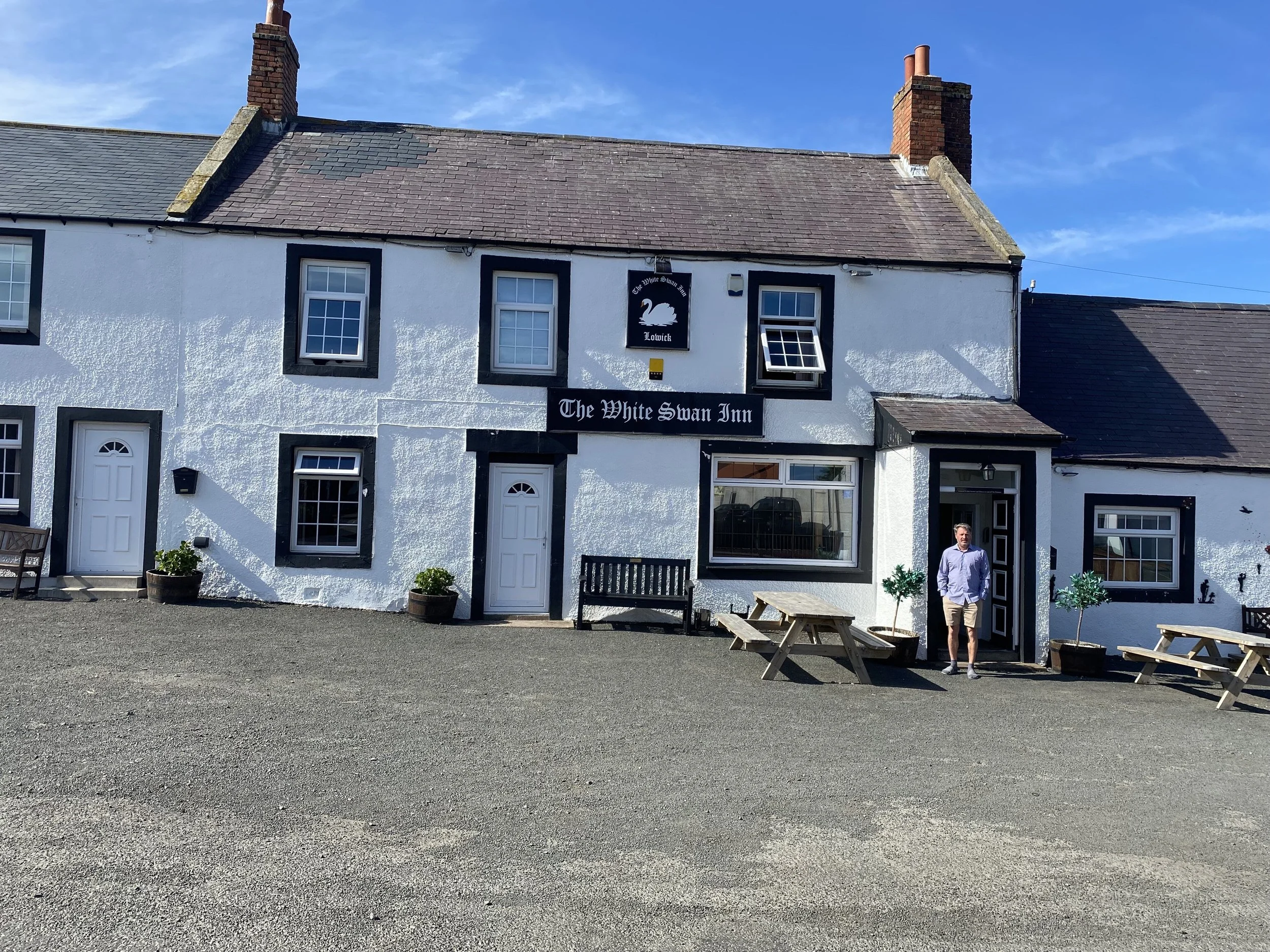
The White Swan Inn

The castle on Holy Island
Day 7: Fenwick to Lindisfarne (Holy Island)
6 miles/9.6 km
Ascent: 50 ft./15.25 m
The last day! This is always a bitter-sweet day, the end of the journey, the end of your aching feet, the end of the conversation you have along the trail. But the satisfaction of completing something so challenging, that a few years ago you could never dream of doing, is overwhelming.
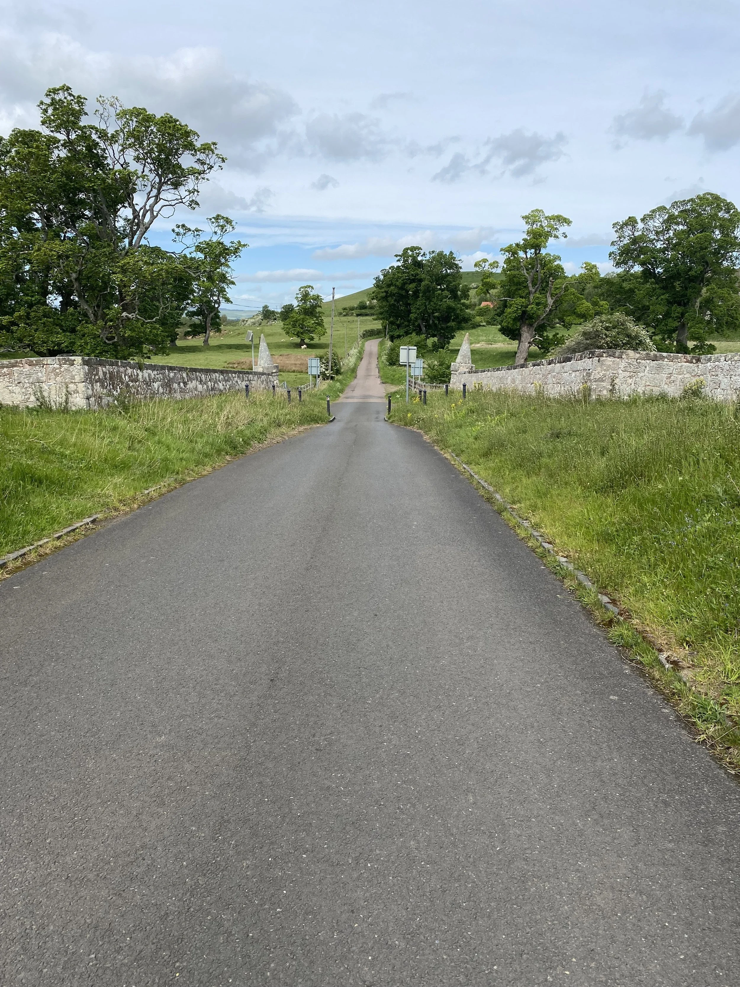
When planning this section, you should do a little homework. Holy Island is a tidal island and the tide goes in and out every 5 hours. The tide times are posted by the causeway, but you will need to Google them to plan your day well. The walk from land to the island is 3 miles and you have 3 miles to go before you reach the crossing point. There are all kinds of local stories about people getting caught in the tide. It is a £8,000 helicopter rescue if you try to cross at the wrong time, so do the homework and have a strong finish.
After another perfect rustic transfer back to where we left off the day before, we started off in great anticipation for the crossing. We were lucky with the tide on that day because the low tide was at 11 am. It could not have been any better. We slept in and walked the first 3 miles slowly (an hour and a half) before arriving at the sand.
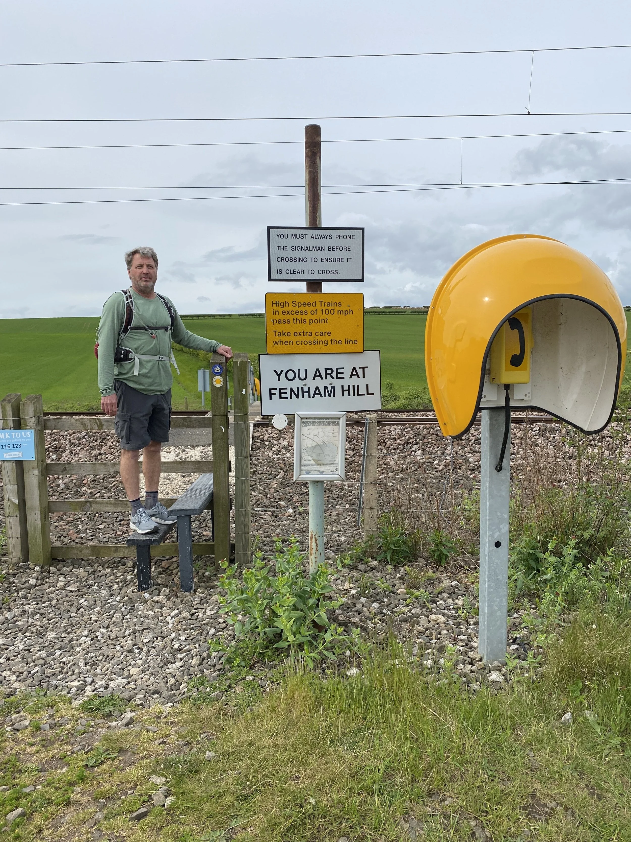
Phone booth and signs before crossing the railroad tracks
The first 2.5 miles were pretty much one long, straight, grassy path set between two fields. Then you come to the train tracks. This was a seriously cool process for crossing train tracks, put in place for people walking St. Cuthbert’s Way. We approached a bright yellow phone booth with the word “danger” and “you cannot cross the railroad tracks until you have called the operator and have been cleared”, written on a sign before the gate. We called the operator and asked if it was safe to cross. The operator on the other side said “no, it is not safe to cross right now call me back when the train has passed”. Hanging up the phone we looked in both directions and as far as the eye can see there were NO trains. We were baffled. We were just calling because it was funny and we wanted to follow the rules. A minute later, a fast train came whipping by us out of nowhere going, we were told, 130 mph. We very easily could have been on the tracks. We called the operator back and asked if it was safe to cross, “yes, it’s safe” said the operator. The tracks were 4 lanes deep and far apart, after climbing stairs over a fence on both sides it took us maybe 3 to 4 minutes as a group to cross. We were very glad we called!
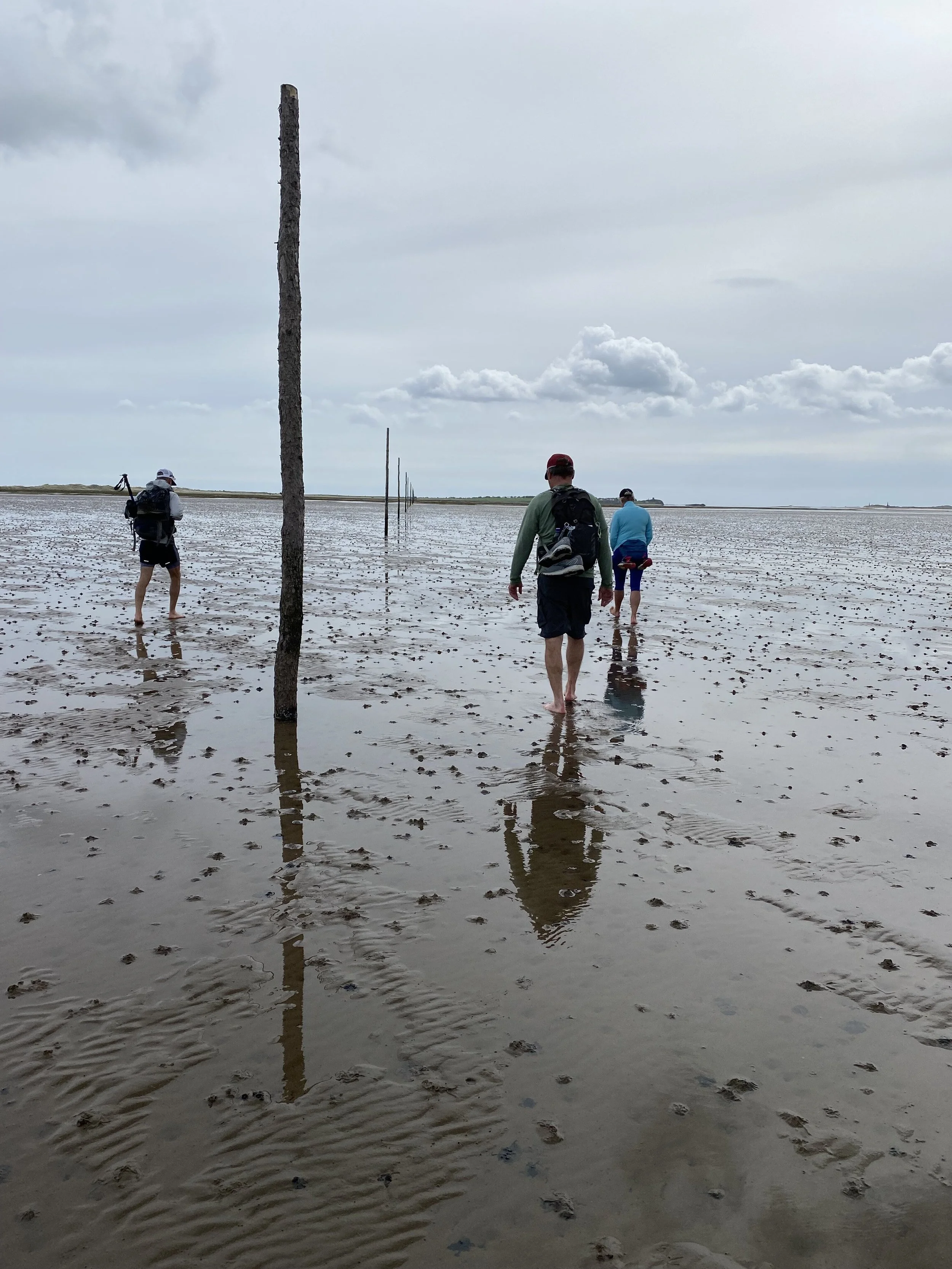
Traditional pilgrim’s path across the sand at low tide
The traditional pilgrim’s path across the sand is the most authentic way to walk the 3 miles to the island. There is a causeway that is busy with tourist buses and delivery trucks, but you can choose to walk this way and keep your shoes on. After some discussion, our group decided to take our shoes off, hook them to the back of our backpacks and head out across the sand. I was very reluctant to walk without shoes, not knowing if there would be glass or sharp rocks. But I thought I should be in the spirit of things and hope for the best.
The sand was hard packed in most places with a few lingering puddles, which was almost easier to walk through than the hard sand. The whole 3 miles were covered in little worm-looking shapes that kept growing and bubbling. For a while, we thought they were worms, but they were the paths of clams digging their way to safety. What a relief, we could walk freely without squashing worms.
There was a section about 75 yards long that was slippery, sinking, black mud. I needed a steady arm and some encouraging words from my husband to not fall flat on my face, and most likely not be able to get up. Without him, I think I would have needed to crawl through this section.

Black mud on feet after the slippery section
I was happy to reach the island relatively clean and unscathed, aside from sore feet that felt like someone gave them a solid scrub down with sandpaper. The sand crossing did not have any glass or sharp rocks, only a few sharp broken sea shells.
At the end of the tall marker poles, just as you climb over some large rocks to dry land, there is a bench where you can sit down. We poured our leftover water over our feet, brushed off the sand, and sat for a while until our feet dried enough to put our socks on.
Just beside the bench is a large sign that reads, “Welcome to Holy Island”. We had another walker take a photo of the four of us in front of the sign and counted this as the end of our trek. Unfortunately, there is no official end or signpost to say you have completed St. Cuthbert’s Way. There is a small chapel in the center of town, St. Cuthbert’s Church, where they plan to put a stone plaque outside to mark the official end.

Statue of St Aidan at Lindisfarne Priory could be considered the final waymark
We stayed on the island for two nights so we could wander around the village and tour the castle and abbey. I would highly recommend doing this if you have the time. The village is small with three inns, three pubs, and lots of cute shops, but the real reason to stay is when the tide is due to come back in, the tours and day sightseers leave the island to avoid being stranded. The island quietens, calms, and takes a deep breath from the hustle and bustle of the day.

Quiet and peaceful